

Drawing on the last three decades of scholarship in critical cartography and critical GIS, Mapshop begins from the premise that maps are more than windows on the world. Maps not only provide a record of geographic phenomena but also impact the conditions of knowing itself. This ‘more-than-representational’ viewpoint enables a productive urgency at the heart of a collaborative or participatory mapping endeavor.
Workshop in Geospatial Technologies (GEO509)
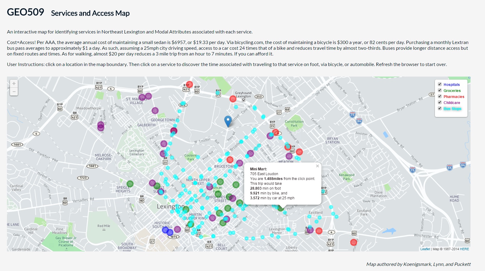
Every year, the Department of Geography offers GEO509 Workshop in Geospatial Technologies, and Mapshop has been fortunate to work with the students of this course. The goal for the course is to prepare each student as a responsive and responsible mapmaker, at a moment in digital culture when there are many maps but few stories being told through them. To meet this goal, this course furthers the concept of the community mapshop -- an intensive studio experience in which students use mapping technologies in collaboration, when appropriate, with community partners. These partnerships have involved students in a full range of collaborative mapmaking: working with peers and community partners to invest in a study area, acquiring and preparing data for spatial analyses, communicating with those impacted by or implicated in these analyses, and producing compelling geographic representations.
In our latest volume, created by students in Fall 2021, we worked with Studio Louisville (in the College of Design) to help examine the Preston Avenue Corridor, with a specific attention to rent gap across five sites:
Archived projects from previous offerings of GEO509:
- Community_Atlas_2015.pdf
- Garden_Map_WWB_MR_2015.png
- Lex_Schools_MR_2015.pdf
- BGT_Plaques_MR_2015.jpg
- Lex_Travel_MR_2015.pdf
- Facade_Dichotomy_MR_2015.pdf
- Lex_Routes_MR_2025.pdf
- Household_Spending_Final_2015.pdf
- Lex_Routes_Final_2015.pdf
- Lex_Schools_Final_2015.pdf
- Services_Final_2015.jpg
- BGT_Plaques_Final_2015.pdf
- Landlords_Final_2015.pdf
- Housing_Stock_Final_2015.pdf
- Johnson_Final_2015.pdf
- Decker_Mills_Final_Poster.pdf
- Martinez_Poster_Final.pdf
- Philp_Boll_Final_Poster.pdf
- Decker_Gosser_Mills_Midreview_Poster.pdf
- Philp_Boll_Midreview_Poster.pdf
- Community_Mapshop_2016.pdf
- Blandford_Kilcoyne_Food_2019.pdf
- Dohner_Bame_Food_2019.pdf
- Empie_Maynard_Trejo_Education_2019.pdf
- Gordon_Banjoko_AlAdawi_Race_2019.pdf
- Gosser_Martinez_Breseman_Greenspace_2019.pdf
- Spurgeon_Poston_Disability_2019.pdf
- Mapshop-Community-Atlas-2020.pdf
- Mapshop-Studio-Louisville-2021.pdf
- Preston_census2020analysis.pdf
- Preston_gentrification-model.pdf
- Preston_jobcenters-foodbanks-educational-employment.pdf
- Preston_poverty-race-commercial-opportunity.pdf
- Preston_transportation-equity.pdf
- GEO509_2025-final-report.pdf
